Glymur Waterfall Guide: A Mighty Sigth in West Iceland
If you're heading to Iceland and love nature and adventure, you’ve got to check out Glymur Waterfall. It's Iceland's second-highest waterfall, and getting there involves a fun hike with amazing views. This guide will help you plan your visit to Glymur, with tips on what to wear, what to expect, and other cool places nearby.
Key Takeaways
- Glymur was considered Iceland's tallest waterfall from 2007 to 2011 when Morsárfoss Waterfall was discovered.
- Glymur is located in West Iceland.
- To see Glymur you need to complete a hike that takes approximately 3-3.5 hours.
- There are many other worth-seeing attractions close to Glymur.
Why is Glymur Worth a Visit?
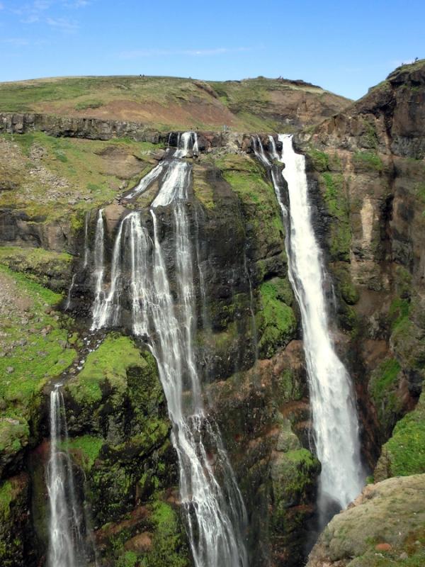
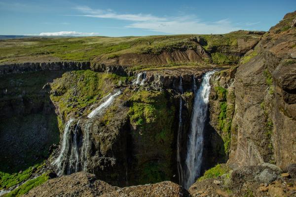
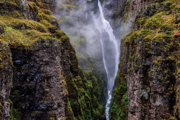
Glymur is not just a waterfall; it's an adventure. Standing at 198 meters (650 feet), Glymur was once considered the highest waterfall in Iceland before the discovery of Morsárfoss. The journey to Glymur involves a scenic hike through diverse landscapes, including a lava cave, a river crossing, and panoramic views that make every step worth it. The natural beauty and the thrill of the hike make Glymur a unique destination that should be on every traveler's itinerary.
Glymur Facts & Features
Here's everything you need to know about Glymur Waterfall.
Height and Name
Glymur boasts a height of 198 meters (650 feet), making it the second-highest waterfall in Iceland. The name "Glymur" translates to "rumble" in Icelandic, aptly named after the resonant sound of the waterfall cascading down the cliffside.
Location
Glymur is located in the picturesque Hvalfjörður fjord in western Iceland. This fjord is renowned for its serene beauty, rich history, and less-crowded tourist spots, offering a peaceful retreat from the more popular destinations in Iceland.
Discovery
Glymur was only discovered in 2007 when it emerged from the Morsárjökull glacier, part of the larger Vatnajökull glacier. This relatively recent formation is due to the glacier's retreat, which revealed the hidden falls.
Where’s Glymur and How to Get There
Reaching Glymur is relatively straightforward from Reykjavik, Iceland’s capital. It's about a 1.15-hour drive from Reykjavik to the starting point of the hike. To get there, drive on Road 1 towards Akranes, then take Road 47 towards Hvalfjörður. Look for signs directing you to the Glymur parking area, where the hike begins.
The Hike to Glymur
You can hike to Glymur Waterfall in two different ways: as a loop or as an out-and-back hike.
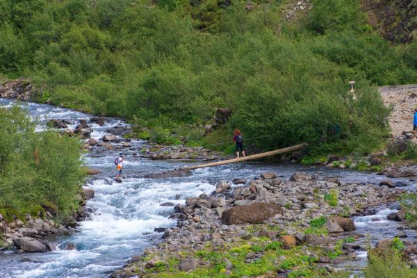
Out-and-Back Hike: Start on the east side of the river, hike up to the waterfall, and return the same way. In the summer, you'll cross the river on a log bridge.
Loop Hike: For a bit more adventure, start on the east side, cross the river above the waterfall, and come back down the west side. This route adds a second river crossing and offers different views of the waterfall. We recommend this route, as it spices up the experience.
Key Points of the Hike:
- Starting point, Trailhead at Botnsdalur: Begin your hike at the parking area in Botnsdalur, where the trailhead is clearly marked.
- Lava Cave: Early in the hike, you’ll pass through a cool lava cave, adding a touch of geological excitement.
- First river crossing: You'll encounter a thrilling river crossing with a log bridge and a cable for support. This part can be exciting and requires careful steps, especially if the water level is high.
- Panoramic views: As you climb higher, the views open up to stunning panoramas of the Hvalfjörður fjord and the surrounding landscape. This is a great spot for taking photos.
- Ascent to the waterfall: The last part of the hike involves some rock scrambling. It’s a bit challenging, but the amazing view of Glymur Waterfall makes it worth the effort.
- Descent and second river crossing: This river crossing is safer than the first one, but since there’s no log, bridge, etc, you’ll 100% get wet.
- Hike to the parking lot: There are two different trails. Although more challenging, we recommend the one by the riverbank since it offers a beautiful (and different) view of the waterfall.
What to Wear When Visiting Glymur
Given the varied terrain and weather conditions, it's essential to dress appropriately for the hike. Here are some recommendations:
- Hiking Boots: Sturdy, waterproof hiking boots are a must for the rocky and potentially slippery paths.
- Layered Clothing: The weather in Iceland can be unpredictable. Wear layers that can be easily added or removed.
- Waterproof Gear: A waterproof jacket and pants will protect you from rain and the spray from the waterfall.
- Hat and Gloves: Even in summer, it can get chilly, especially in the early morning or late afternoon.
- Backpack: Carry a small backpack with essentials like water, snacks, a map, and a first-aid kit.
Surrounding Sites & Things to Do Near Glymur
Glymur is not the only natural wonder to enjoy in the area.
Hvalfjörður Fjord
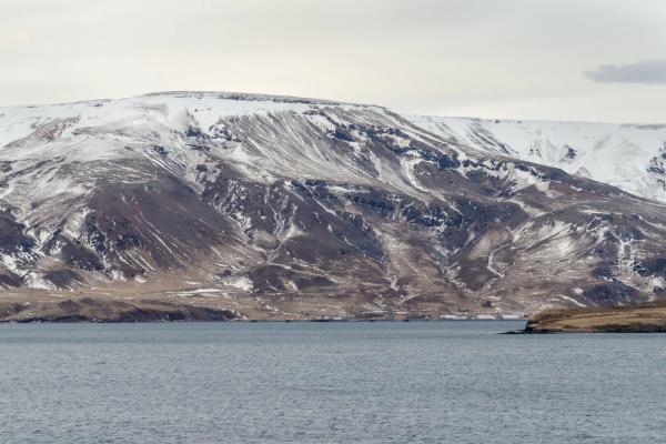
While in the area, take some time to explore Hvalfjörður fjord. Known for its tranquil beauty, the fjord is dotted with smaller waterfalls and offers opportunities for fishing, bird watching, and leisurely walks along the shoreline.
Þingvellir National Park
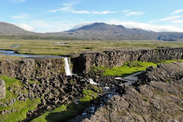
A short drive from Glymur, Þingvellir National Park is a UNESCO World Heritage site rich in both natural beauty and historical significance. Here, you can witness the rift between the North American and Eurasian tectonic plates, explore ancient lava fields, and even snorkel in the crystal-clear waters of Silfra Fissure.
Hraunfossar and Barnafoss
Located near Reykholt, Hraunfossar and Barnafoss are two stunning waterfalls that offer a unique visual spectacle. Hraunfossar, or "Lava Falls," features water flowing from beneath a lava field, while Barnafoss, or "Children’s Falls," is known for its turbulent waters and tragic folklore.
Conclusion
Glymur Waterfall offers an unparalleled adventure through some of Iceland’s most beautiful and varied landscapes. From the exhilarating hike to the breathtaking views, every aspect of visiting Glymur promises a memorable experience. Whether you're a seasoned hiker or a casual nature lover, Glymur is a destination that captures the essence of Iceland's natural beauty and spirit of adventure.


