A Museum of Wonders: Iceland’s Landscapes Full Guide
Nature comes in many different ways. The elements that shape and make up our planet are diverse special, and sometimes create absolutely uncommon formations. Some countries or regions have more natural, geological, and geographical variety than others, though. And if we focus on places that are unique and completely different, one of them is, without a doubt, Iceland.
Located in the middle of the North Atlantic Ocean, this small island nation offers landscapes that feel as if they were from another planet but are intensely real at the same time. Iceland's dramatic geography results from millennia of volcanic eruptions, glacial movements, and the constant interplay of tectonic plates. It’s a land where glaciers carve through volcanic rock, where waterfalls thunder into deep canyons, and where geothermal energy can be witnessed in many different forms.
Some of these elements are so strange and different that they have inspired hundreds of mythological and fantastic stories. Tales of trolls and elves are told in many corners of the country, and these stories add an extra layer of magic to its already mystical scenery. For many travelers, Iceland is not just a place to visit but a place to experience and connect with the primal forces of the Earth.
In this guide, we will take you through the main types of landscapes you will encounter on your trip to Iceland. We’ll also focus on certain places that are perfect examples of the wide range of natural monuments this astonishing country has.
Key Takeaways
- Iceland's variety of landscapes is surprisingly diverse, especially considering its modest size.
- Here you can find waterfalls, volcanoes, glaciers, lava fields, black sand beaches, and much more.
- Each region has its own charm, and all of them are worth a visit.
Geological Features of Iceland
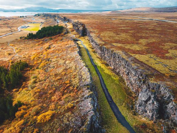
From a geological point of view, Iceland is a paradise. Firstly, it’s located on the Mid-Atlantic Ridge, which is the boundary between the Eurasian and North American tectonic plates. This means that, technically, Iceland is on two continents. These plates are pulling apart at a rate of about 2 centimeters per year, and this movement has shaped Iceland into a dynamic and ever-changing land. However, this is just one of many factors that have made Iceland so geologically diverse.
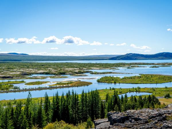
There is a place where this border can be seen at its best. The Þingvellir National Park, a UNESCO World Heritage Site, is perfect to witness the effects of tectonic activity. Here, you can walk through Almannagjá, a massive drift valley created by separating the tectonic plates. Also underwater, in the Silfra fissure, you can swim while touching both plates simultaneously. The park also has historical significance—it’s the site of Iceland’s first parliament, the Alþingi, established in 930 AD.
Volcanoes have played a very important role, too. The country’s volcanic origins mean that much of the terrain is made up of basalt rock, lava fields, and geothermal hotspots. Lava flows from ancient eruptions have cooled, creating surreal shapes in the process, with places like Eldhraun, the largest lava field in the world, formed by the Laki eruption in 1783. With the passing of the years, these fields are now covered with a thick layer of moss, which turns vibrant green in the summer, and the contrast between the volcanic rocks and the moss is something to behold.
Glaciers have also been key in shaping the landscapes of Iceland. These massive tongues of ice move slowly but relentlessly, creating valleys and ice caves.
Volcanoes and Volcanic Landscapes
One of the elements that have a bigger visual impact on the Icelandic landscapes is the volcanic activity. Iceland is known as the ‘Land of Ice and Fire,’ and there’s a reason why. The island is one of the regions in the world with the highest number of active volcanoes. And some of them are some of the world’s most fascinating ones. The country has more than 130 active and inactive volcanoes, so it’s no surprise that eruptions have played a major role in shaping it. These eruptions, sometimes quite destructive, have also created some of Iceland’s most striking landscapes.
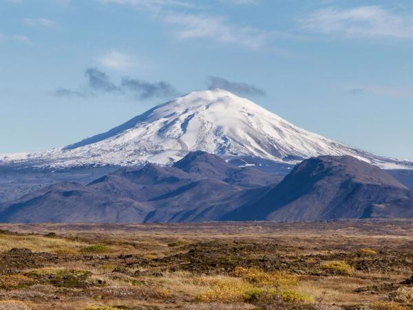
One of the most famous volcanoes here in recent times is Eyjafjallajökull. Its 2010 eruption made headlines around the globe as it grounded air traffic across Europe. The eruption left behind a stark and dramatic landscape with fresh lava flows and ash-covered fields. Not far from it, the Hekla volcano has erupted more than 20 times in recorded history. In medieval times, the early island settlers believed it was the gate to hell.
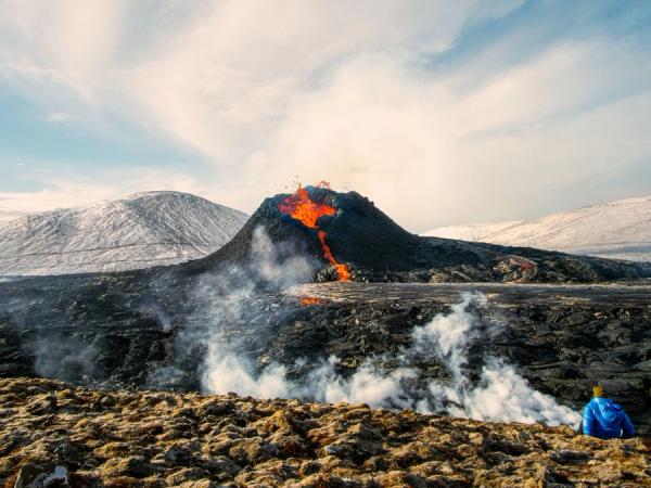
The relatively recent eruption of Fagradalsfjall in 2021 brought renewed attention to Iceland’s volcanic activity. Located in the Reykjanes Peninsula near Reykjavík, this eruption created rivers of glowing lava that attracted visitors and locals alike. Today, the cooled lava fields are a popular hiking destination, offering a glimpse of Iceland’s volcanic power and its effect with time.
And again, in late 2024, a new eruption near Fagradalsfjall made it to the news everywhere in the world. A new fissure has opened near the town of Grindavík, highlighting once more the constant activity below the surface in Iceland.
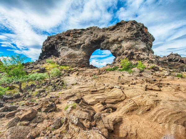
The volcanic landscapes of Iceland aren’t limited to lava flows and craters. Places like Dimmuborgir, a vast field of lava pillars and caves in North Iceland, feel like stepping into another world. The name translates as “Dark Castles”, as it’s what this place resembles from a distance.
Glaciers and Ice Caves
While fire dominates much of Iceland’s story, ice is equally important. Glaciers cover about 11% of the island, and they play a critical role in shaping its geography. These immense ice caps not only feed Iceland’s many rivers and waterfalls but also create spectacular landscapes that draw visitors from all over the world.
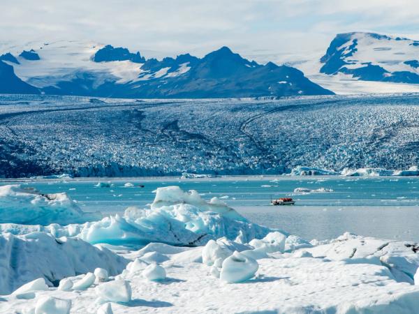
The king of all the glaciers is Vatnajökull, the largest in Europe. Located in the national park with the same name, it’s a centerpiece of Iceland’s icy beauty. It has a surface of more than 8,100 square kilometers, and it’s so vast that it hides several active volcanoes beneath its ice cap. The interplay between fire and ice is particularly dramatic here, as volcanic eruptions can cause sudden floods, known as jökulhlaups, that have a big impact on the surrounding landscape.
Exploring Iceland’s glaciers becomes even more attractive if we pair it with their ice caves, which are accessible during the winter months. These caves are temporary formations created as meltwater carves intricate tunnels through the ice. When the weather gets colder, the water freezes again, creating new structures. This is a circular process, with new caves forming each year, so they never look the same. The ice walls in some caves also have traces of black ash compressed inside the ice, creating a surprising contrast.
The Crystal Ice Cave, located within Vatnajökull, is a fantastic example. Its vivid blue walls and surreal formations make it a favorite among photographers and adventurers.
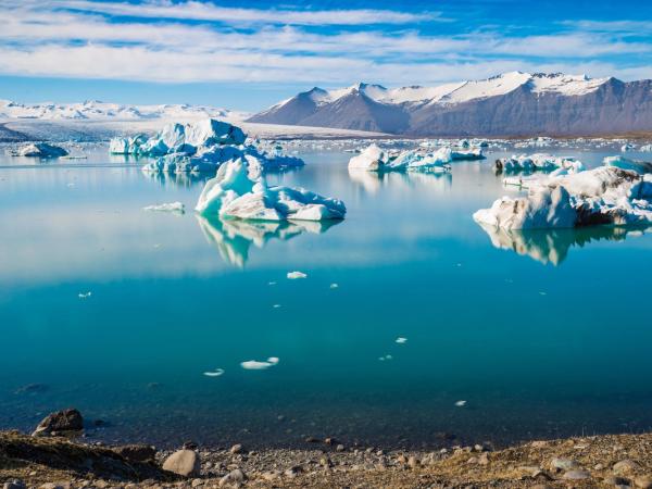
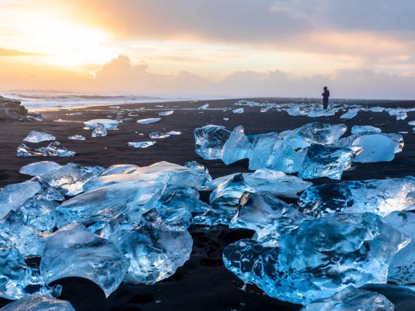
The Jökulsárlón Glacier Lagoon is another must-visit site. Located at the edge of Vatnajökull, this glacial lake is filled with icebergs that have separated from the glacier and float on the water before drifting slowly to the ocean. Many of them end up in the nearby Diamond Beach, creating a beautiful contrast between the blue ice and the black sand.
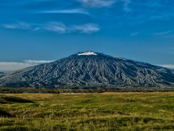
Other notable glaciers include Langjökull, where you can get inside man-made ice tunnels, and Snæfellsjökull, in the Snæfellsnes Peninsula. This glacier sits atop a huge dormant stratovolcano that inspired Jules Verne’s Journey to the Center of the Earth.
Waterfalls
A guide to Iceland’s landscapes wouldn’t be complete if it didn’t mention waterfalls. They are among its most iconic features, and it’s easy to see why. These cascading torrents of water are fed by glaciers, rivers, and frequent rainfall, and there are hundreds of them scattered around the country in all sizes, shapes, and, sometimes, colors. Each waterfall is unique, offering its own story and personality.
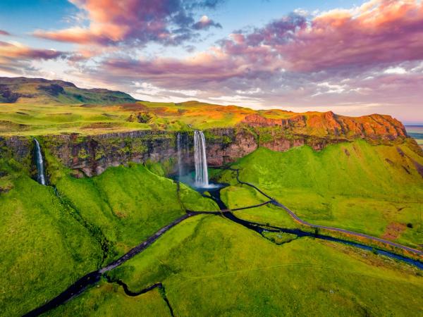
Seljalandsfoss, located along the South Coast, is one of Iceland’s most visited and photographed waterfalls. Its 60-meter (198 feet) drop is impressive on its own, but what makes Seljalandsfoss truly special is the pathway that allows you to walk behind the falls.
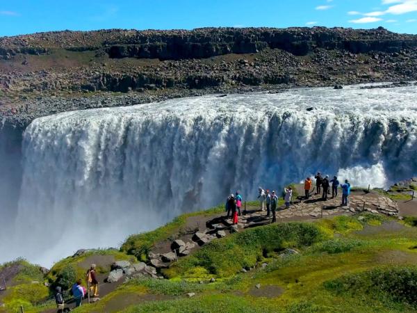
If you want to witness strength and power, Dettifoss, in the north, is Europe’s second most powerful waterfall. Its sheer volume and force are humbling, and the surrounding canyon adds to the dramatic atmosphere. Standing near Dettifoss, you can feel the ground tremble beneath your feet as the water thunders into the depths below. There are viewing points on both sides of the waterfall.
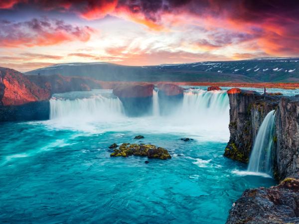
There’s another waterfall in the same region that, as it happens with Dettifoss, is part of the Diamond Circle, a scenic route that connects several natural monuments in North Iceland. Goðafoss is famous not for its size but for the striking blue color of its waters.
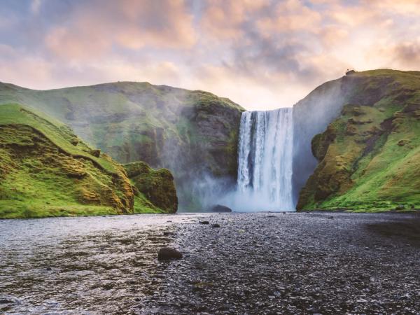
Skógafoss is another South Coast gem, with a wide, powerful cascade that often creates a colorful rainbow on sunny days. There’s also a legend tied to this place that says that a Viking settler named Þrasi Þórólfsson hid a treasure chest behind the waterfall.
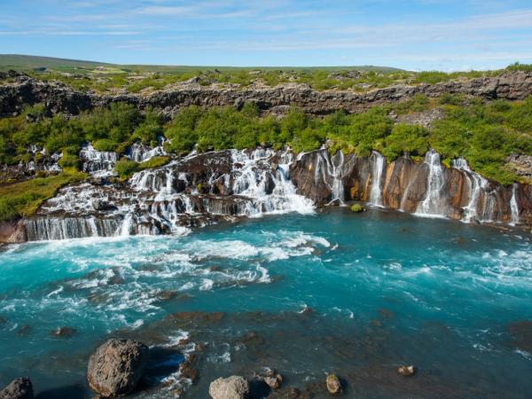
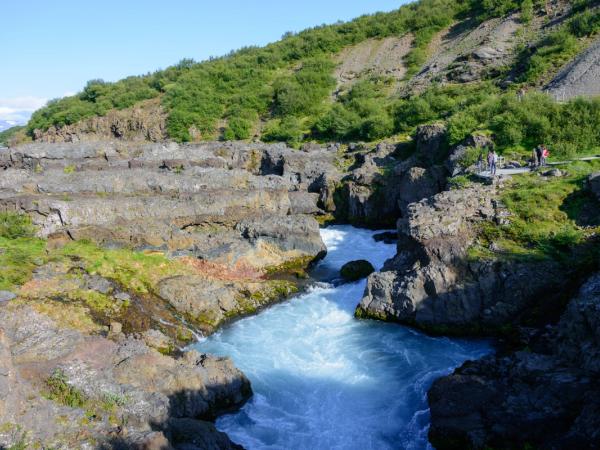
In West Iceland, we can find two nice waterfalls. They are not as tall and powerful as the ones described before, but they are well worth a visit. The first one is called Hraunfossar, a series of small waterfalls that emerge directly from a lava field, creating a quiet and picturesque scene. The second one, Barnafoss, which is not far upstream, is a series of small cascades on the Hvítá River.
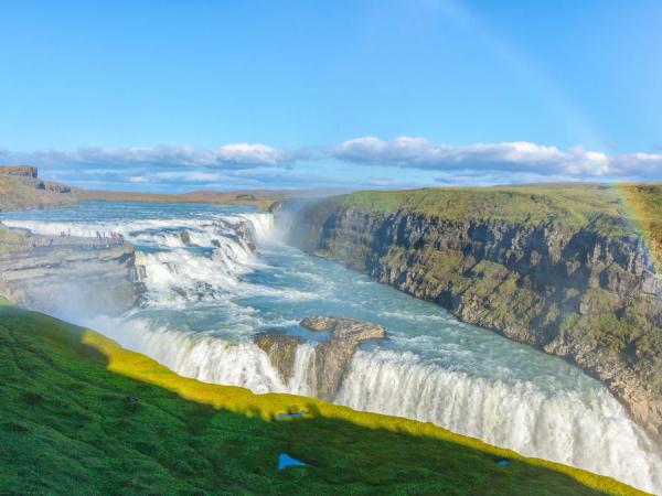
However, perhaps the most famous waterfall in all of Iceland is Gullfoss, part of the Golden Circle route. This two-tiered waterfall plunges into a rugged canyon, and on sunny days, the sun's rays create a colorful effect on the mist. That’s why this waterfall is also known as “Golden Falls.”. Gullfoss is a powerful symbol of Iceland’s natural beauty and its deep connection to its rivers and glaciers.
There are many more waterfalls all over the island, and most of them are worth your time. We selected a few to offer a glimpse of the variety there is in Iceland.
Geothermal Areas
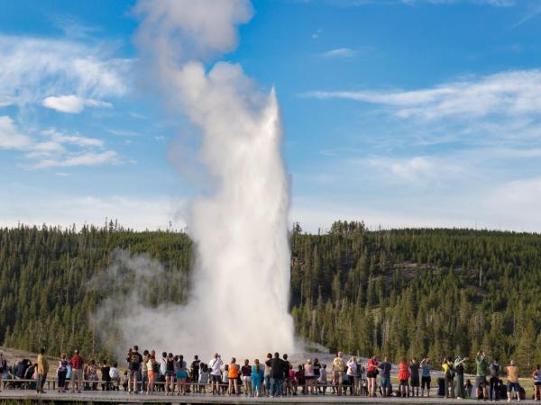
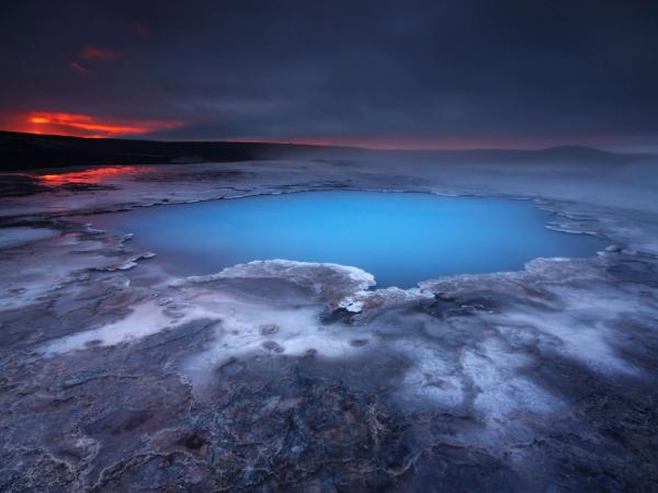
Iceland’s geothermal activity is a defining feature of its landscape. The island is a hotspot of geothermal energy, and this is evident in its many geysers, hot springs, and fumaroles. One of the most amazing places in this sense is the Geysir Geothermal Area, one of the three main stops of the Golden Circle. It’s home to the famous Strokkur geyser and one of the best places to witness this geothermal power in action. Strokkur erupts every 5 to 10 minutes, sending a column of boiling water up to 20 meters (65 feet) into the air.
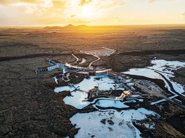
Geothermal activity becomes more pleasant for tourists who come to Iceland in one of the many hot springs and geothermal spas in the country. The Blue Lagoon, near Reykjavík, is perhaps the most famous geothermal site. This man-made spa is fed by geothermal water, rich in silica and minerals, and its milky-blue waters are really attractive.
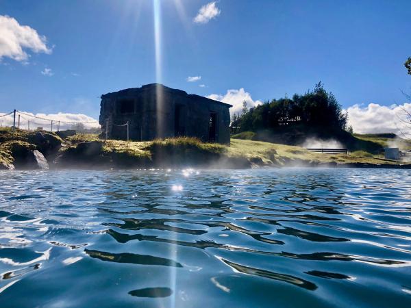
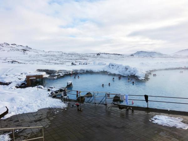
For a more natural experience, the Secret Lagoon in Flúðir and the Myvatn Nature Baths in the north are cheaper and quieter options. These hot springs are surrounded by stunning landscapes, making them perfect spots to unwind. There’s no better way to finish a day of exploration than relaxing in one of these places in the middle of an astonishing landscape. It’s also a cultural experience, as Icelanders have traditionally used geothermal baths as places to gather and socialize.
Fjords
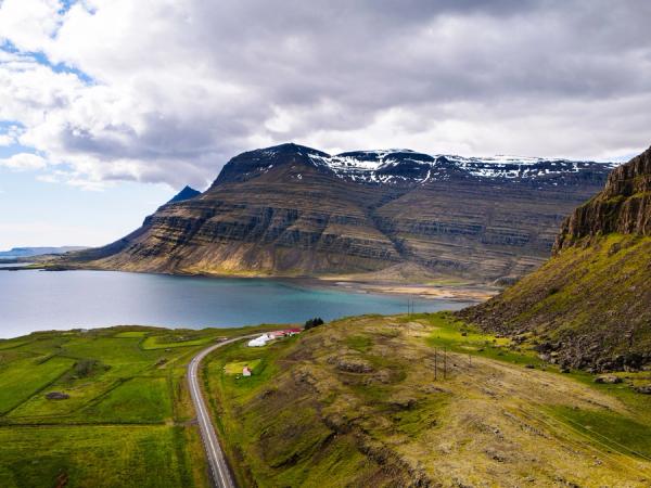
When one thinks about fjords in Europe, the mind probably goes straight to Norway, home to many of these large and famous bodies of water. But Iceland also has them. And there are a lot and quite beautiful as well. There are two regions in Iceland where fjords are the main feature: the Westfjords and the Eastfjords.
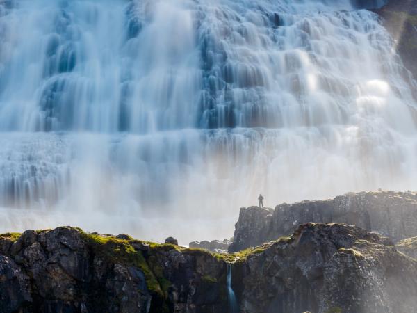
Located actually in the northwest corner of the country, the Westfjords is a remote and isolated region where the landscapes are dramatic and rugged, with steep cliffs and deep, narrow fjords. This part of the country is usually less visited but incredibly rewarding for those who make the journey. Dynjandi, a massive multi-tiered waterfall, is also one of the Westfjords’ crown jewels, and the region’s coastline is full of wildlife, including puffins and Arctic foxes.
The Eastfjords, on the other hand, are not as dramatic, but they are beautiful natural monuments. This region is dotted with charming fishing villages and is known for its reindeer populations, which can be seen roaming the hills and valleys.
The Highlands
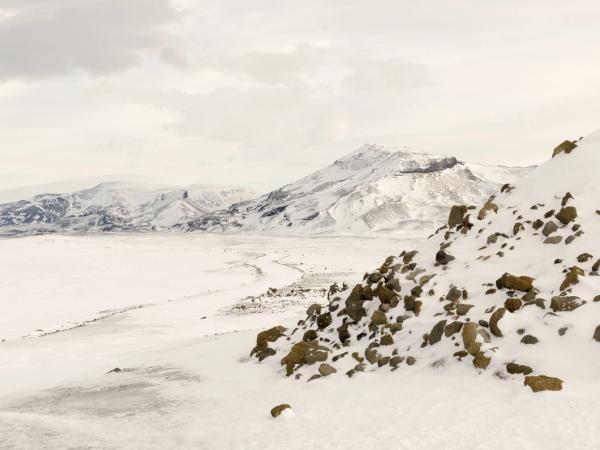
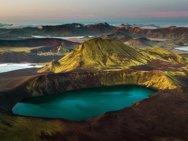
The Highlands are Iceland’s wild heart, a vast and uninhabited region that offers some of the country’s most untouched landscapes. This area has one of the coldest climates in the whole country, and the region is only accessible during the summer months (June to August). The heavy snowfall and other weather events force the authorities to close the roads in this region (the infamous F-roads) for the rest of the year.
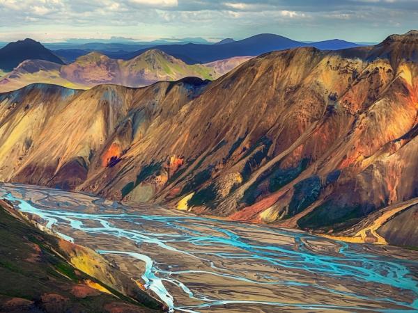
One of the best places in the Highlands is Landmannalaugar, with its multicolored rhyolite mountains and natural hot springs. The area is the starting point of the Laugavegur Trail, a multi-day hike that takes visitors through geothermal valleys, black sand deserts, and lush green valleys.
The Highlands are a place of extremes, where the beauty of nature is on full display. Whether you’re exploring the black sands of Sprengisandur or the geothermal vents of Hveravellir, the Highlands offer a sense of adventure and solitude that’s hard to find anywhere else.
Coastal Landscapes and Black Sand Beaches
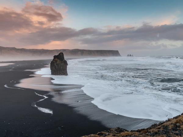
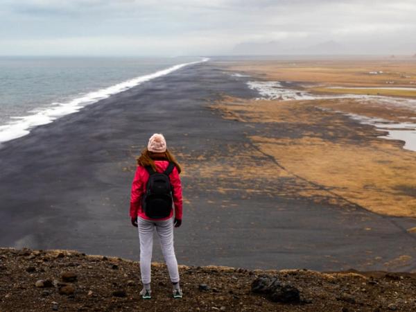
Apart from the fjords, the coasts of Iceland are as varied as its interior, with black sand beaches, sea stacks, and rugged cliffs. Reynisfjara, near Vík, is the most famous of these beaches. Its black volcanic sand and towering basalt columns create a beauty difficult to find in many other places, especially when contrasted with the crashing waves of the Atlantic.
We have talked before about Diamond Beach, near Jökulsárlón. Here, chunks of ice from the glacier lagoon are scattered across the black sand, sparkling like diamonds in the sunlight, hence the beach's name.
From the cliffs of Dyrhólaey, there are breathtaking views of the coastline, and it is a prime spot for birdwatching, particularly puffins in the summer months. In the west, the Snæfellsnes Peninsula has a dramatic coast, including the jagged rock formations of Lóndrangar and the nice and quiet beach of Ytri-Tunga.
Canyons
Iceland's canyons are shaped by natural forces that have acted over thousands of years. Most of them were formed during and after the last Ice Age through a combination of glacial activity and river erosion. As glaciers advanced and retreated, they carved deep grooves into the landscape. When the glaciers melted, the resulting rivers continued to erode these grooves, cutting deeper into the bedrock and forming the canyons we see today.
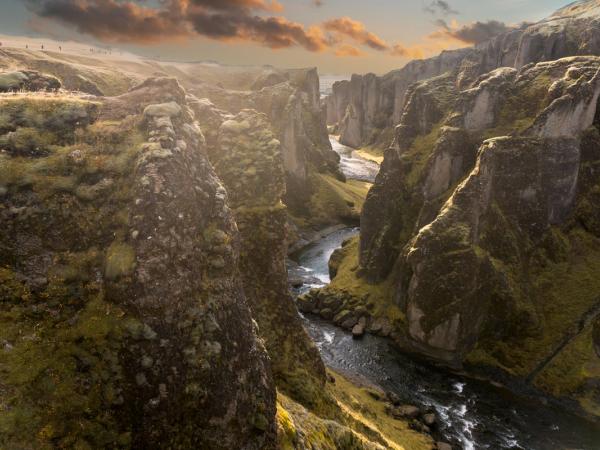
One well-known canyon is Fjaðrárgljúfur in the southeast. It's about two kilometers long and up to 100 meters deep. Formed around 9,000 years ago, this canyon was created by the Fjaðrá river eroding the soft palagonite rock left behind by retreating glaciers. The river's constant flow gradually wore away the bedrock, deepening the canyon over time.
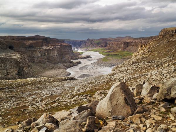
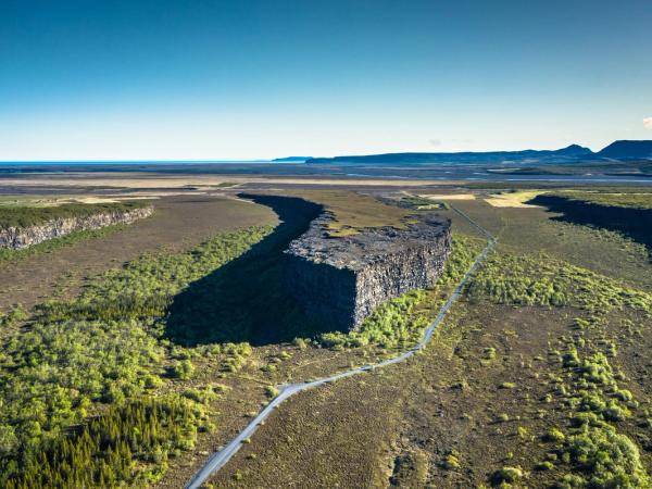
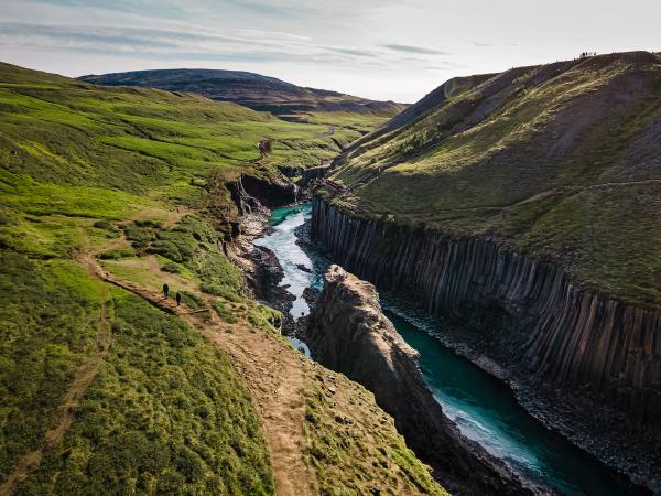
In the north, Jökulsárgljúfur Canyon is one of the country's largest canyons and is part of Vatnajökull National Park. This canyon was mainly formed by massive glacial floods known as jökulhlaups. These floods happened when volcanic eruptions under glaciers caused sudden melting, releasing large amounts of water that rapidly carved through the rock. Within this canyon is Ásbyrgi, a horseshoe-shaped valley that also resulted from these powerful floods. The area's steep cliffs and unique formations are direct results of these natural events. Another unique spot is Stuðlagil Canyon in East Iceland. It stands out for its tall basalt columns and the bright blue glacial river running through it. The contrast between the dark columns and the vivid water makes it a striking place to visit.
Conclusion
Iceland’s landscapes are a testament to the power and beauty of nature’s extremes. This is the land where fire meets ice, where waterfalls thunder and glaciers glow, and where the Earth’s raw energy is visible at every turn. Each region offers its own unique charm, making Iceland a destination that is waiting for you to explore it.
The variety of natural places that are all packed in a relatively small country is simply outstanding. If you are seeking adventure and inspiration, Iceland is not just a place to visit—it’s a place to connect with the elemental forces that shape our world. It’s a journey into the extraordinary, a reminder of nature’s beauty, and an experience that will stay with you forever.

