
Kirkjubæjarklaustur, a volcanic village in South Iceland
Jump to chapter
In South Iceland, where the land displays a wide variety of different natural monuments, where volcanic plains meet astonishing waterfalls, there are also a few towns that are quiet but charming stops for travelers. One of them is Kirkjubæjarklaustur, a small village surrounded by lava rocks covered in moss and rugged cliffs. This place, which goes way back in history, is a great option to use as a base to explore all the great things this region of Iceland has waiting for you.
Key Takeaways
- Kirkjubæjarklaustur is a small town located by the Ring Road in South Iceland.
- It’s very close to the Eldhraun Lava Field, one of the best volcanic natural monuments in the country.
- The history of Kirkjubæjarklaustur can be traced back to the early settlers of the island.
About Kirkjubæjarklaustur
Kirkjubæjarklaustur is a modest village in South Iceland’s Skaftárhreppur municipality, and is home to approximately 180 people. Its name can be translated as “church farm cloister,” and makes reference to its deep Christian roots, tracing back to Irish monks, or “Papar,” who, according to the sagas of the Icelanders, settled here before the Norse arrived in the 9th century. By 1186, a Benedictine convent was established where the town stands today. In fact, there are places near the town whose names are tied to these origins, such as Systrafoss (Sisters’ Waterfall) and Systrastapi (Sisters’ Rock), which are named after two nuns.
The village lies in a region defined, both geographically and geologically, by the Laki eruption of 1783–1784. It was a catastrophic volcanic event that profoundly impacted the region and its surrounding areas. It took place along a 27-km (16.7 miles) fissure in the highlands and produced one of the largest basaltic lava flows in recorded history. It left behind awesome landscapes, such as the Eldhraun and Skaftáreldahraun lava fields. Over eight months, the eruption released approximately 14.7 km³ of lava and vast amounts of toxic gases, including sulfur dioxide, causing a huge environmental catastrophe.
In Iceland, the eruption led to crop failures, livestock deaths, and a famine that killed about 20–25% of the population (around 9,000–10,000 people) on the island at the time. The eruption also had a significant impact on the global climate, lowering temperatures and triggering extreme weather in Europe, North America, and Asia, resulting in crop problems and increased mortality. Its legacy left a deep mark on Iceland’s landscape and historical memory, especially around Kirkjubæjarklaustur.
Nowadays, Kirkjubæjarklaustur has become a service hub along the Ring Road and a significant stop between Vík í Mýrdal and Höfn, two of the most important cities in Southern Iceland. The town has a supermarket, a gas station and several places to enjoy some local food. Beyond its practical amenities, the village’s charm lies in its proximity to several natural wonders. There are also a few hiking trails that depart from the town where you can explore its nice surroundings, such as birch forests and basalt formations.

Where’s Kirkjubæjarklaustur & How to Get There
One of the most convenient aspects of Kirkjubæjarklaustur, travel-wise, is that the famous Ring Road, or Route 1, passes by the town. It lies approximately 250 km (155 miles) east of Reykjavík, making it a convenient stop on a road trip through the South Coast. The best way to get to Kirkjubæjarklaustur and to move around Iceland in general is by renting a car. The drive from the capital takes about 3.5 hours without stops, but there’s plenty to see on the way, so take your time and explore it if you feel like it.
The itinerary is quite straightforward and easy to follow. Start by taking Route 1 eastbound. Soon after you’ve passed Vík í Mýrdal (187 km / 116 miles), you’ll start to see the immense Eldhraun Lava Field, telling you you’re getting close to your destination. Once you’ve crossed the bridge over the river Fjaðrá, you’ll get to a roundabout. Take the third exit to get to the town’s center.


The Weather at Kirkjubæjarklaustur
The weather in Iceland is as varied and surprising as its landscapes. The climate is not the same all over the country. The south usually gets more rain and wind, but is not as cold as the center or the north of the island. Here's what you can expect season by season.
Spring (April and May)
After the long winter, the fields around Kirkjubæjarklaustur start to wake up. The temperatures usually move between 2–6°C (36–43°F), but the weather patterns change constantly, blending sunny spells with sudden showers, gusty winds, or late snowfalls in the first weeks of April. The days lengthen every week, reaching up to 16 hours of natural light at the end of May. The fields start revealing their green color and the flowers bloom, but the trails like the one leading to Fjaðrárgljúfur may be muddy or slippery. Waterproof jackets, layered clothing, and sturdy hiking boots are essential to feel comfortable outdoors.
Summer (June to August)
Summer offers the mildest weather, with temperatures between 8–14°C (46–57°F) and occasional highs near 20°C (68°F). By the end of June, the sun barely sets, with up to 21 hours of daylight, providing great conditions to explore the area. However, rain is frequent, but are usually short spells, mixed with sunshine. The location of Kirkjubæjarklaustur, on an open plain and not far from the sea, leaves it exposed to the wind.
Autumn (September and October)
The temperatures begin to drop, usually hovering at 4–9°C (39–48°F), and the days get gradually shorter. Rainfall intensifies, and winds grow fiercer, while early snow can happen in higher elevations by late October. On the other hand, the fields start to change colors, getting a beautiful orange and golden tone. There are not many tourists during this time, though.
Winter (November to March)
In Iceland, winters are long and difficult, but they create some astonishing sights. This season transforms Kirkjubæjarklaustur into a snowy wonderland, with temperatures hovering around 0–3°C (32–37°F) but often dipping below freezing during storms. The days are really short, with barely 4 hours of natural light by the winter solstice, so it’s essential to plan accordingly. The roads become tricky to drive on, as they can be covered in black ice, so extra care is needed. On the other hand, in winter is when there are more chances to see the Northern Lights.

Things to do in Kirkjubæjarklaustur
Kirkjubæjarklaustur is a paradise for nature lovers, offering stunning lava fields, breathtaking waterfalls, and extensive trails for those who want to experience Iceland’s landscapes firsthand. I’d recommend swinging by the Visitor’s Center to ask for recommendations once you’re there.
Stjórnarfoss
Just 2 km from Kirkjubæjarklaustur, Stjórnarfoss is a lovely two-tiered waterfall that most tourists miss. Getting there is easy - turn onto Road 203 at the village roundabout, drive 1 km past Kleifar campsite, then walk 100 meters to the falls. The water drops about 15 meters over volcanic rocks, making it perfect for photos, especially during early morning or late afternoon. It's a great spot for a peaceful picnic, away from the crowds you'll find at Iceland's famous waterfalls.

Rauðárfoss
Rauðárfoss, or "Red River Falls," is pretty unique with its rusty-colored water flowing through impressive basalt columns. The reddish color comes from iron in the soil and looks amazing against the black basalt. You can't drive right up to this one - you'll need to hike from the Systrafoss trail in the village toward Systrastapi. When the water is low, you can hop across the river, which gives you a better look at those cool basalt formations.

Systravatn Viewpoint
Hike up from Systrafoss in the village, and after about 30 minutes of climbing, you'll reach Systravatn Viewpoint, about 100 meters above Kirkjubæjarklaustur. The climb gets steeper as you go, but the views are worth it - you can see the village, the surrounding valley, and on clear days, even Vatnajökull glacier. At the top, you'll find Systravatn (Sisters' Lake) and a marker called the "Golden Nugget." Bring good shoes - the path gets slippery when wet.

Skaftareldahraun Lava Field
The huge Skaftareldahraun lava field was formed during the 1783-1784 Laki eruption, one of the biggest volcanic events ever. Now it's covered in soft, green moss that has taken hundreds of years to grow. You can see it from the Ring Road between Kirkjubæjarklaustur and Vík, or walk on the marked paths like Gönguleið um Eldhraun near the village. Just stay on the trails - step on that moss and you'll damage something that takes decades to recover.

Systrafoss Waterfall
Systrafoss (Sisters' Waterfall) is right in Kirkjubæjarklaustur itself - a double waterfall named after the nuns who lived at the convent nearby. Follow the trail beside the falls up to Systravatn lake - it gets steeper but gives you amazing views. The whole walk takes about an hour, and on clear days you can see all the way to Vatnajökull glacier. The falls look most impressive during spring when snow is melting or after it rains.

Kirkjugólf (Church Floor)
Just east of the village, you'll find Kirkjugólf or "Church Floor," a patch of natural basalt that's so flat and perfectly tiled that early settlers thought someone built it. It looks like a smaller version of Ireland's Giant's Causeway. It only covers about 80 square meters and you can see it in 5-10 minutes right off the Ring Road. There's a sign explaining how it formed, and it's right near Hildishaugur if you're into geology and old stories.

Systrastapi (Sisters' Rock)
West of Kirkjubæjarklaustur stands Systrastapi (Sisters' Rock), linked to a dark story about two nuns who were executed for alleged sins. The climb is challenging - they've added ropes to help on the steeper parts - but you get amazing views of the surrounding glaciers. Start the hike near Systrafoss, pass by Rauðárfoss, and cross the river when it's low enough. Besides the views, it's a cool connection to Iceland's medieval history.

Hildishaugur Burial Mound
Near Kirkjugólf is Hildishaugur ("Hildir's Mound"), just a small rocky hill with a fascinating story. Old texts say that when a pagan named Hildir Eysteinsson tried to settle in this Christian area in the 10th century, he instantly dropped dead at the boundary and was buried here. A sign explains the story and its importance during Iceland's settlement. It takes just a few minutes to see, and it works perfectly with nearby stops if you're interested in local history.
What to See and Do Near Kirkjubæjarklaustur
Iceland’s South Coast is, probably, the most prolific region in Iceland when it comes to natural attractions, which means Kirkjubæjarklaustur is just a stone's throw from some of the best places to visit in the country.
Eldhraun Lava Field
Stretching east and south of Kirkjubæjarklaustur, the Eldhraun Lava Field is a vast and stunning remnant of the 1783–1784 Laki eruption, which reshaped this part of the country. It’s a huge and uneven field made of lava rocks covered in a fluffy and mushy coat of green moss. It’s one of the biggest lava fields in the world. There’s a road, Route 204, that does a loop around the field and connects with the Ring Road in two different points, one of them just outside Kirkjubæjarklaustur. Several trails allow you to explore the area, but be careful, stepping onto the moss is forbidden, and the damage created by doing so could take decades to recover.

Fjaðrárgljúfur Canyon
Just a 12-minute drive from Kirkjubæjarklaustur, we can find Fjaðrárgljúfur, a 2-km-long /1.24 miles), 100-m-deep (328 feet) canyon sculpted by the Fjaðrá River over millennia. It’s the same river that passes by Kirkjubæjarklaustur. The walls of the cliffs are covered in moss, with the river running at the bottom, and the views are quite impressive. There’s a short trail that runs along the edge of the canyon with several viewpoints from where you can look straight down at the river. The path is mostly flat and well-maintained, so almost anyone can do it.

Katla Geopark
This natural park covers most of the volcanic landscapes in Iceland. In fact, Kirkjubæjarklaustur is inside the park. Here, we can find glaciers, craters, and lava fields shaped by the eruptions of different volcanoes, such as Katla and Laki. The Skaftárstofa Visitor Centre in the village features interactive exhibits on the region’s geology, including the global impact of the Laki eruptions in the 18th century. There is a network of hiking trails that lead to different parts of the park, and guided tours can also be booked.

Þakgil
A little bit further west from Kirkjubæjarklaustur on the Ring Road, there’s a small gravel road that leads to this secluded place. Þakgil is a narrow valley surrounded by cliffs covered in green moss that shield it from the winds that are usually common in South Iceland. It’s only accessible in the summer, and the road leading there requires a 4x4 vehicle. There’s a trail there that goes to the top, with great views of the whole area. There’s also a campsite there with a natural cave used for communal barbecues.

Skaftafell
This place is a little bit further away than the rest, but it’s worth the trip. Located 70 kilometers (43 miles) east of Kirkjubæjarklaustur, this nature reserve was once a national park, but was later integrated into Vatnajökull National Park. It’s like a playground for nature lovers, with glaciers, forests, and volcanic plains. It has a large network of hiking trails that range from easy walks to Hundafoss waterfall to challenging treks like Sjónarnípa, overlooking Hvannadalshnúkur, Iceland’s tallest peak.

Svartifoss
This waterfall is one of the most iconic of the many that can be found in Iceland. It’s inside Skaftafell, but it's so beautiful we had to mention it separately. Svartifoss, or the “black waterfall” is a 20-m waterfall framed by hexagonal black basalt columns. The 1.8-km (1.1-mile) trail from the Skaftafell Visitor Centre, a 45-minute hike, goes through birch woods, which are not very common in Iceland, and views of the Vatnajökull glacier. The famous Hallgrímskirkja Church in Reykjavík is designed following the waterfall’s unique structure.

Where to Stay in Kirkjubæjarklaustur and Nearby
Not many people stay in Kirkjubæjarklaustur, but there are many accommodation options if you decide to.
Kirkjubær Camping Ground and Cottages
Located in the village center, this family-friendly site offers tent pitches, campervan spots, and cozy cottages with basic amenities. Guests also have access to a communal kitchen and views of Systrafoss. It’s ideal for budget travelers seeking a convenient base for nearby attractions.
Hótel Klaustur Iceland
A modern, four-star hotel just off Route 1, Hótel Klaustur provides comfortable rooms with a minimalist style. Its on-site restaurant serves Icelandic cuisine, and the staff can arrange tours to Skaftafell or Jökulsárlón.
Klausturhof Guesthouse
This charming guesthouse in the village offers simple, clean rooms with shared or private bathrooms. You'll appreciate the warm hospitality, nice breakfasts, and proximity to Systrafoss.
Magma Hotel
Five km (3 miles) south of Kirkjubæjarklaustur, Magma Hotel blends boutique style with rural charm. It has cabins with floor-to-ceiling windows overlooking a small lake and Eldhraun Lava Field.
Hunkubakkar Guesthouse
Situated 7 km (4.3 miles) from the village, this guesthouse offers cozy rooms and cottages with shared or private bathrooms. Surrounded by nature, it’s a peaceful spot for families or groups to enjoy. You can enjoy homemade breakfasts and easy access to Fjaðrárgljúfur.
Hotel Laki
Hotel Laki combines modern rooms and rustic cabins with stunning countryside views. Its restaurant specializes in local fish and lamb dishes, and the staff organizes excursions to Laki Craters.
Travel Tips
- Driving: Rent a 4x4 vehicle for winter trips or if you want to go to Þakgil, as the gravel road can be rough. Always check the road status before starting your day.
- Monitor the Weather: Iceland’s weather changes rapidly. Wear waterproof clothing, warm layers, and sturdy shoes year-round. A windproof jacket is essential for exposed areas.
- Respect Nature: Stick to marked trails in Eldhraun and other sensitive areas to protect the fragile environment, which can take centuries to recover. Avoid stepping off paths or littering.
- Cash and Cards: Most businesses in Kirkjubæjarklaustur accept cards, but it's a good idea to carry some Icelandic króna for small vendors or campsites. The village has a bank and an ATM.
- Daylight Hours: Plan around daylight, especially in winter when hours are short (4–6 hours). Summer’s near-constant light gives plenty of time for exploration.
South Iceland: A Region of Wonders
South Iceland, stretching from Reykjavík to the East Fjords, is a cornerstone of the country’s tourism, drawing visitors with its diverse landscapes and accessible attractions. The region has a bit of everything this country is known for, from black sand beaches and towering waterfalls to glaciers and volcanic fields.
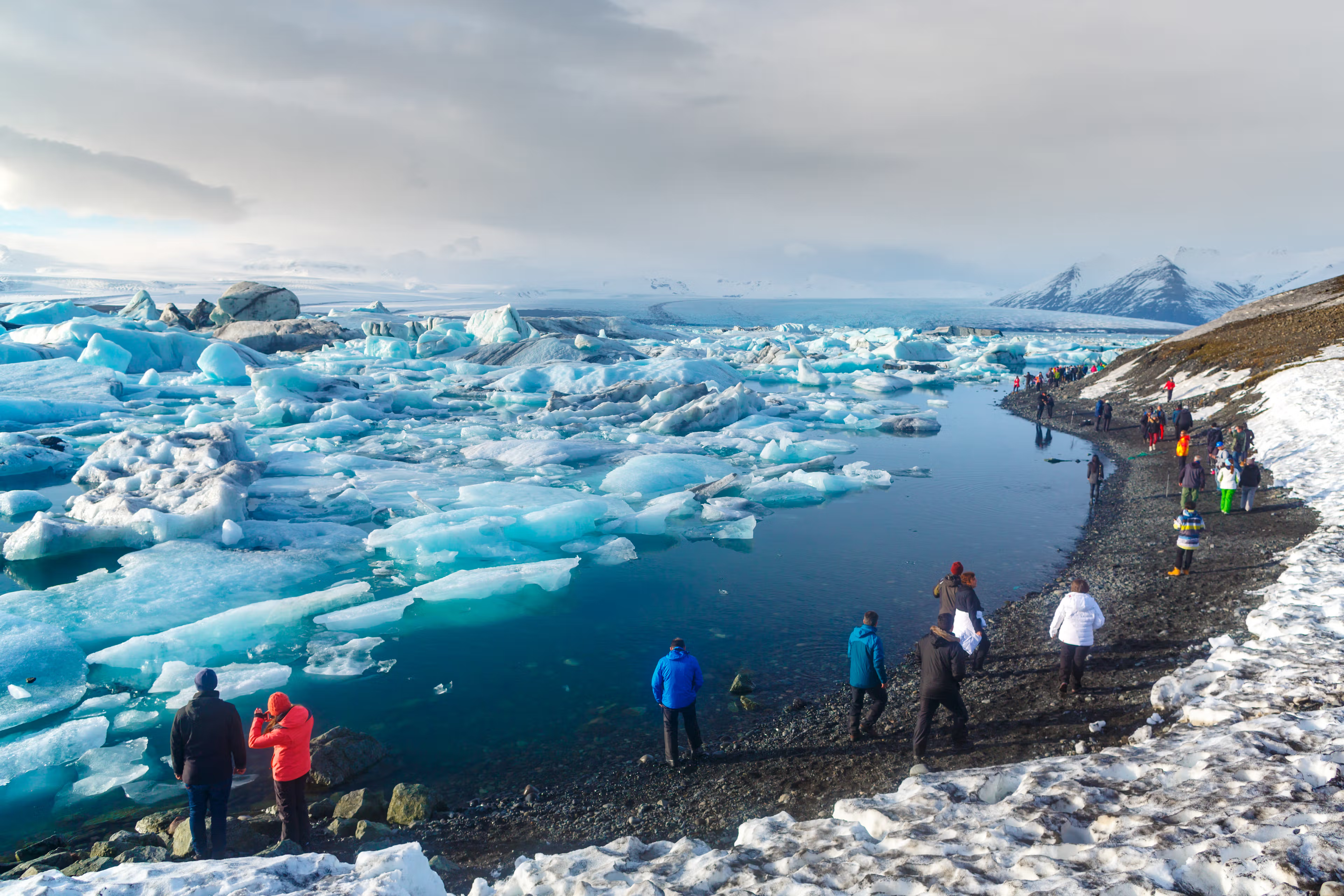
It’s home to iconic sites like Seljalandsfoss, Reynisfjara Beach, and Jökulsárlón Glacier Lagoon, all within a day’s drive from Kirkjubæjarklaustur. The Katla Geopark, which encompasses the village, is an excellent place to learn about the region's and country's volcanic history, featuring geological marvels such as lava fields and basalt formations formed over centuries of volcanic activity. The region is well connected and easy to travel, with well-maintained roads and flat surfaces.


Conclusion
Kirkjubæjarklaustur may be small, but its charm and surroundings are far from it. The town is situated in one of the most diverse and attractive regions in Iceland, and it is near some of the country's best attractions. The village has an interesting history and can serve as a great base for exploring this region. Plan your visit and discover why this hidden gem deserves a spot on your travel itinerary.
Latest Blog Posts
 South Coast
Kirkjubæjarklaustur, a volcanic village in South Iceland
In South Iceland, where the land displays a wide variety of different natural monuments, where volcanic plains meet astonishing waterfalls, there are also a few towns that are quiet but charming stops for travelers. One of them is Kirkjubæjarklaustur, a small village surrounded by lava rocks covered in moss and rugged cliffs. This place, which goes way back in history, is a great option to use as a base to explore all the great things this region of Iceland has waiting for you.
 Places to Visit
Gatklettur: Iceland's Stunning Stone Arch
Iceland is packed with cool sights, but some of the best ones are hiding away from the busy tourist spots. Gatklettur is a natural stone arch sitting on the Snæfellsnes Peninsula – a hidden gem most travelers miss. Here’s everything you need to know before you go.
 Highlands
Gjáin Valley in Iceland: A Hidden Treasure in the Highlands
Iceland has tons of amazing landscapes, but Gjáin Valley truly stands out. This green paradise tucked in the Icelandic Highlands feels magical for anyone willing to step off the tourist path. Planning a trip to Iceland? Here's what you should know about this special spot.
