Understanding the Tectonic Plates in Iceland
Iceland, often called the land of fire and ice, is a place where dramatic landscapes meet some pretty amazing geological features. With towering volcanoes, huge glaciers, and steaming geysers, it's a destination like no other. But have you ever thought about why Iceland is so geologically active? The answer lies deep under the Earth's surface, where tectonic plates are always moving.
Key Takeaways
- Iceland lies on a divergent plate boundary—the Mid-Atlantic Ridge—where tectonic plates pull apart.
- This causes volcanic activity, geothermal features, and earthquakes, shaping the land and providing energy.
- Iceland serves as a natural laboratory for studying plate tectonics and geological processes.
A Simple Look at Plate Tectonics
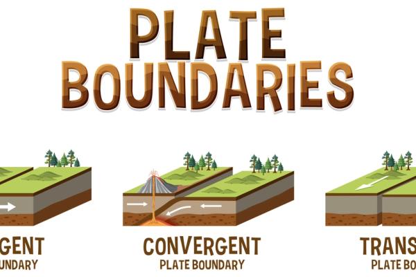
To get a sense of what makes Iceland’s geology so special, it helps to know a bit about plate tectonics. The Earth's outer layer, called the lithosphere, is broken into several big and small pieces known as tectonic plates. These plates float on a softer layer below them and are always moving, though very slowly. The places where they meet create three types of boundaries: divergent, convergent, and transform.
- Divergent Boundaries: Plates move away from each other.
- Convergent Boundaries: Plates push toward each other.
- Transform Boundaries: Plates slide past one another.

What Happens at Divergent Boundaries?
At divergent boundaries, tectonic plates pull apart. As they move away, magma rises from below to fill the gap, creating new crust as it cools. This process usually happens along mid-ocean ridges, forming underwater mountains. The constant creation of new crust is a big part of how the Earth's surface keeps changing.
So, What Kind of Plate Boundary Runs Across Iceland?
Iceland sits right on top of the Mid-Atlantic Ridge, which is a divergent boundary where the North American and Eurasian plates are pulling apart. This ridge stretches over 16,000 kilometers (around 10,000 miles) along the Atlantic Ocean floor. What makes Iceland special is that it’s the only place where the ridge rises above sea level. The North American Plate is to the west of Iceland, and the Eurasian Plate is to the east.
Around 20 million years ago, volcanic eruptions caused by this boundary began to build up layers of lava on the ocean floor. Over time, these layers grew and eventually rose above sea level, forming Iceland. This process is still happening today as the plates continue to move apart at about 2 centimeters (0.8 inches) per year. As magma rises and cools, it slowly adds new land to the edges of the island, changing its shape bit by bit.
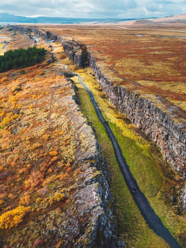
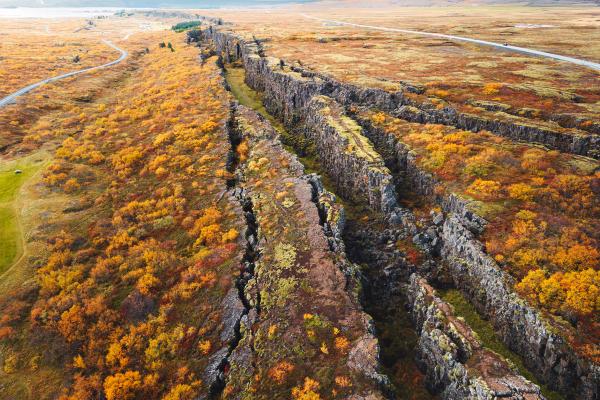
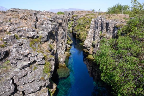
At Thingvellir National Park, you can actually see the gap between the North American and Eurasian plates. The Almannagjá Gorge is a striking example of how the separating plates have shaped the landscape, and you can even walk between two continents. The park also features the Silfra Fissure, a water-filled gap between the plates that’s popular for snorkeling and diving in its crystal-clear waters.

The Mid-Atlantic Ridge and Iceland’s Geology
This divergent boundary in Iceland causes a lot of volcanic and geothermal activity, which gives the island its rugged look. Volcanic eruptions have shaped the mountains, valleys, and lava fields, while underground heat creates hot springs and geysers. These natural features are not only fun to explore, but they also play a big role in generating renewable energy, with geothermal power used to heat homes and produce electricity.

Iceland’s Key Geological Features
Iceland’s landscape is shaped by the strong forces beneath its surface. Volcanoes, hot springs, and earthquakes are all part of what makes this island so special. Here’s a closer look at these key features.
Volcanic Activity
Iceland has over 130 volcanic mountains, and eruptions happen roughly every four years. Some of the most well-known volcanoes include Eyjafjallajökull, which erupted in 2010 and caused a lot of trouble for air travel, and Hekla, which was once called the "Gateway to Hell." These eruptions happen when magma rises between the plates, creating new landforms.
Geothermal Activity
Iceland's geothermal landscape is also a result of its tectonic setting. Hot springs and geysers, like the famous Great Geysir, are scattered across the land. Geothermal energy is super important to Iceland, with around 90% of homes being heated this way. It also generates about 25% of the country’s electricity.
Earthquakes
Earthquakes are common in Iceland, though most are small and barely noticeable. These tremors are a constant reminder of the tectonic activity going on beneath the surface as the plates move and magma shifts.
The Scientific Importance of Iceland
Iceland is a natural laboratory for scientists studying plate tectonics and volcanic activity. Researchers from around the world come to observe these processes up close. Iceland’s glaciers also offer important data on climate change, making the country a key spot for climate studies. Educational tours and field studies help us better understand how our planet works.
Conclusion
Iceland is a stunning example of how our planet is constantly changing. Its location on a divergent plate boundary creates amazing landscapes and provides insights into geological processes. Whether you’re a curious traveler, a scientist, or someone who loves nature, Iceland offers a unique look at the forces that shape our world.

