A Complete Guide About Volcanoes in Iceland
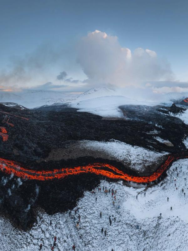
Iceland is shaped by its many volcanoes, vital to the island's landscape and way of life. These powerful forces create new land, provide renewable energy, and draw visitors from all over the world. Understanding the role of volcanoes helps explain why Iceland is such a unique and fascinating place.
In this post, we'll dive into the history and importance of Iceland’s volcanic activity and run you through some of its most impressive and important volcanoes.
Key Takeaways
- Iceland has more than 130 volcanoes, 30 of which are still active.
- The most recent eruption took place in November 2024.
- There are eight volcanic zones in Iceland, all different in activity and geology.
- Many of the volcanoes in Iceland can be visited via hike, jeep tour, helicopter tour, etc.
Overview of Iceland’s Volcanic History
Iceland sits right on top of the Mid-Atlantic Ridge, where the North American and Eurasian tectonic plates pull apart, which is why the island has so many volcanoes. On top of that, there’s a hotspot underneath the island feeding even more volcanic activity. Altogether, Iceland has about 130 volcanic mountains, with around 30 of them still active. Since people first settled in Iceland around 870 AD, there have been over 170 eruptions—more than 50 of those happened in the last hundred years alone. The island’s geology is constantly changing, shaped by everything from slow-moving lava flows to dramatic ash explosions.
Iceland is pretty young geologically. Volcanic eruptions started forming the land about 16 to 18 million years ago, and those eruptions never really stopped. Each added another layer to the island, creating the rugged landscapes you see today—massive lava fields, volcanic cones, and steaming hot springs. Volcanoes like Hekla and Katla are well-known and have erupted multiple times throughout history, while others, like Grímsvötn, sit under glaciers and occasionally melt their way through the ice, causing sudden floods.
Some eruptions have left a huge mark on both Iceland and the rest of the world. The Laki eruption in 1783–1784, for example, was so massive that it caused a famine, killing nearly a quarter of Iceland’s population and even affecting weather patterns across the Northern Hemisphere. More recently, Eyjafjallajökull erupted in 2010, sending ash high into the sky and shutting down air travel across Europe for days. In 2021, after sitting quietly for around 800 years, Fagradalsfjall erupted on the Reykjanes Peninsula, drawing tourists and locals eager to see the lava up close.
Living with volcanoes is just part of life in Iceland. While eruptions can be disruptive, they’re also a source of energy and tourism, and they’ve shaped the landscape in ways that draw millions of visitors every year. We have learned to roll with it, often saying "Þetta reddast," which means something like “it’ll all work out.” No matter what, volcanoes are part of what makes Iceland such a fascinating place to explore.
Top 10 Volcanoes in Iceland
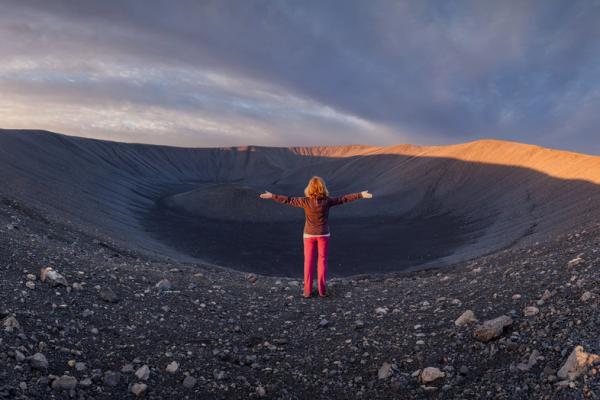
As we said, Iceland has over 130 volcanoes. Of course, some are more impressive than others. The cool thing is that most of them can be visited, and even some can be peaked after a long, well-worth hike. Here’s the list of our favorites.
1. Litli-Hrútur
Litli-Hrútur is one of Iceland’s newest active volcanoes, about 30 kilometers from Reykjavík on the Reykjanes Peninsula. It’s one of the few places where you can see lava flows up close, which you don’t get to do every day. The volcano sits on the Mid-Atlantic Ridge, where two tectonic plates slowly move apart. Its latest eruption in July 2023 drew visitors and scientists. Unlike some of Iceland’s bigger and more explosive volcanoes, Litli-Hrútur’s lava flows are slower, making it easier and safer for people to visit.
Getting to Litli-Hrútur from Reykjavík is easy—just drive toward Keflavík on Route 41, then take Route 43 to Grindavík. The hike is about 20 kilometers round trip and goes over rough lava fields, so it can be tricky at times, but the views make it worth it. If you’re nearby, you can stop at the Blue Lagoon to relax after the hike. It’s smart to check for any volcanic updates before you head out since eruptions and gases like sulfur dioxide can sometimes make the area unsafe.
2. Meradalir
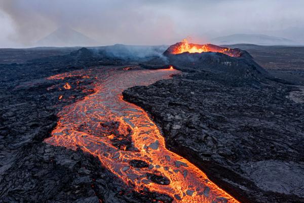
Meradalir is part of the same volcanic area as Litli-Hrútur on the Reykjanes Peninsula. While Litli-Hrútur has fresh lava flows, Meradalir is more about open lava fields from eruptions in 2021 and 2022. The lava flowed for months, spreading across the area. It’s one of the few places where you can walk on cooling lava and see how the land is still changing.
Getting to Meradalir from Reykjavík is simple – just drive toward Grindavík, the same way you would for Litli-Hrútur. The hike is about 10 kilometers round trip, with rough trails and lava underfoot. What makes Meradalir different is how quiet and open it feels, with steam still rising in spots. If you’re visiting Litli-Hrútur, Meradalir is nearby and a good stop to see more of Iceland’s volcanic landscape.
3. Fagradalsfjall
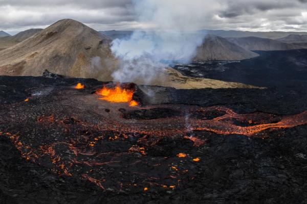
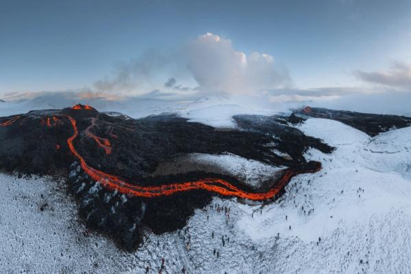
Fagradalsfjall is another volcano on the Reykjanes Peninsula, part of the same volcanic area as Litli-Hrútur and Meradalir. It erupted in March 2021 after being quiet for about 800 years, starting a series of eruptions that have changed the landscape. The most recent eruption occurred from November 20 to December 8, 2024, with lava flowing into nearby valleys. The eruptions at Fagradalsfjall tend to be slow and steady, so it’s a popular spot for people to see lava safely.
The hike to Fagradalsfjall is one of the most popular in the area, with trails going over lava fields and leading to views of the crater. The path can be steep and rough in spots, but it’s shorter and a little easier than the hike to Litli-Hrútur. If you’re visiting Meradalir or Litli-Hrútur, Fagradalsfjall is close by and worth checking out to see how the eruptions have shaped the area differently.
4. Hekla
Hekla is one of Iceland’s best-known volcanoes, standing 1,491 meters (4,892 feet) tall and about 110 kilometers east of Reykjavík on the Ring Road route. Unlike the slower lava flows at Litli-Hrútur or Fagradalsfjall, Hekla is known for sudden, powerful eruptions. It’s sometimes called the “Gateway to Hell” because it can erupt without warning. The last eruption was in 2000, and while it’s been quiet since, scientists keep an eye on it because Hekla doesn’t usually give much time to react.
Hiking Hekla is harder than other volcanoes, with a steep climb to the top. The trail is rough in spots, but the view from the summit stretches over lava fields, glaciers, and mountains. If you’re visiting Iceland’s volcanoes, Hekla offers a glimpse at the more explosive side of things. It’s a good stop if you’re up for a tougher hike and want to see the landscape from one of Iceland’s highest volcanoes.
5. Katla
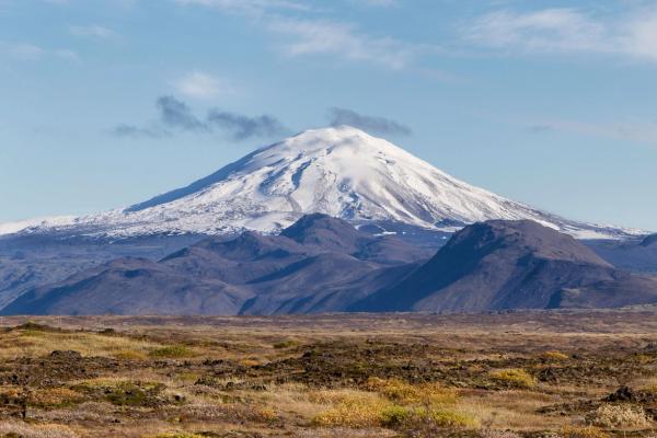
Katla is one of Iceland’s most active and powerful volcanoes, sitting under the Mýrdalsjökull glacier in South Iceland. The volcano is 1,512 meters (4,961 feet) tall and is known for explosive eruptions beneath the ice, which can trigger large glacial floods called jökulhlaups. Katla hasn’t erupted since 1918, but scientists watch it closely because it’s overdue and usually erupts every 40 to 80 years.
Hiking on Katla isn’t as simple as other volcanoes because it’s covered by a glacier, but guided tours can take you to the area. Many tours visit the Katla Ice Cave, where you can walk through tunnels of blue and black ice shaped by past eruptions. Katla gives you a different experience compared to volcanoes like Litli-Hrútur or Hekla – you won’t see lava, but the combination of ice and volcanic activity shows a unique side of Iceland’s landscape.
6. Snaefellsjokull
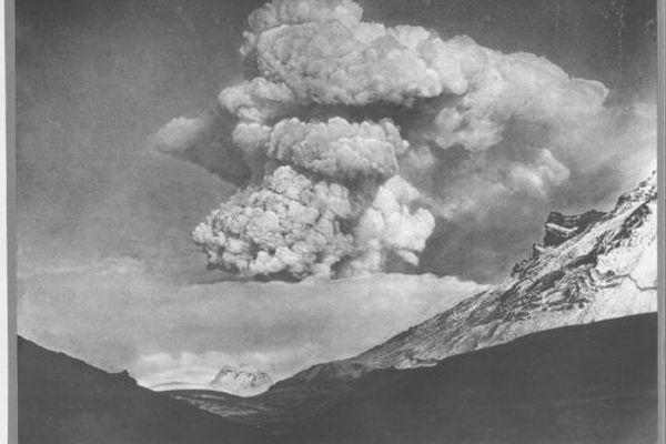
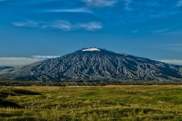
Snæfellsjökull is a glacier-topped volcano at the western edge of Iceland’s Snæfellsnes Peninsula. It stands at 1,446 meters (4,744 feet) tall and is around 700,000 years old. On clear days, you can spot its snow-covered peak from Reykjavík, about 120 kilometers (75 miles) away. The volcano last erupted around 200 CE, with earlier eruptions happening roughly 4,000 and 8,500 years ago. Since then, Snæfellsjökull has been quiet, but it still stands out as one of the most striking landmarks in West Iceland.
Snæfellsjökull National Park surrounds the volcano and has plenty to explore. There are hiking trails, glacier tours, and lava fields. In summer, guided hikes to the summit are popular, while snowcat tours are a good way to get up there in colder months. The area is also home to the Lóndrangar Cliffs and Djúpalónssandur Beach. If you’re up for something different, you can head underground and explore the Vatnshellir lava cave. Snæfellsjökull is also famous for its role in Jules Verne’s Journey to the Center of the Earth.
7. Askja Caldera
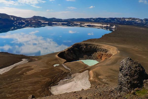
Askja is an active volcanic caldera in Iceland’s central highlands, surrounded by the Dyngjufjöll Mountains. It’s one of the most unique places in the country, known for its wide, open landscape and bright blue lakes. The caldera covers about 50 square kilometers and is home to Lake Öskjuvatn, Iceland’s second-deepest lake at over 200 meters. Next to it is Víti Crater, a smaller lake with warm, milky blue water. Askja’s remote location and rough terrain give it a wild, untouched feel, completely different from more popular volcanoes like Snæfellsjökull or Fagradalsfjall. It last erupted in 1961.
Getting to Askja isn’t easy since it’s deep in the highlands, north of Vatnajökull Glacier. You’ll need a 4x4, and the roads are usually open from late June to early October. If driving on rough roads isn’t for you, there are guided tours in the summer. The hike to the caldera is pretty cool, crossing lava fields and volcanic terrain. Askja’s eruptions, including the big one in 1875 that created Lake Öskjuvatn and Víti, give the area a dramatic feel.
8. Öræfajökull
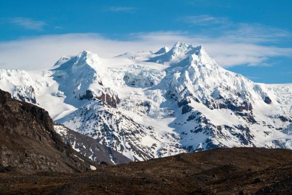
Öræfajökull is Iceland’s biggest volcano and home to the country’s highest peak, Hvannadalshnúkur, which stands at 2,110 meters (6,920 feet). It sits at the southern end of the Vatnajökull glacier, making it part of Vatnajökull National Park, and is mostly covered by ice. The volcano has a 12 km² caldera, and you can see its peak on clear days while driving between Vík and Höfn. Even though it looks calm, Öræfajökull has a history of powerful eruptions that left their mark on the land.
The volcano has erupted twice in recorded history. The worst was in 1362, wiping out nearby farms with floods and ash. Another eruption happened in 1727, but it wasn’t as bad. These days, the area is a popular spot for glacier hikes, ice climbing, and scenic flights. Besides Öræfajökull, the area is home to cool places like Jökulsárlón Glacier Lagoon and Skaftafell Nature Reserve.
9. Eyjafjallajökull
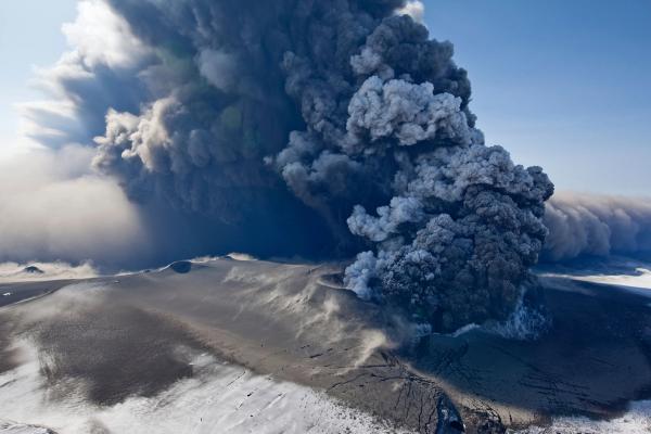
Eyjafjallajökull, meaning “Island Mountain Glacier,” is a glacier-covered volcano in South Iceland, standing 1,651 meters (5,417 feet) tall. It’s just north of Skógar and west of Mýrdalsjökull glacier, in Iceland’s Eastern Volcanic Zone. Eyjafjallajökull is best known for its 2010 eruption, which caused massive ash clouds and shut down air travel across Europe. The eruption caused plenty of problems but also got people curious about Iceland’s volcanoes, bringing more visitors to the area.
There’s a lot to do around Eyjafjallajökull today. The Eyjafjallajökull Visitor Centre talks about the 2010 eruption and how it affected nearby towns. If you want to explore, you can try glacier hikes, snowmobile tours, or super jeep trips to get closer to the volcano. Skógafoss and Seljalandsfoss, two of Iceland’s most popular waterfalls, are nearby, and the Fimmvörðuháls trail takes you between Eyjafjallajökull and Mýrdalsjökull. For more hiking and views, Þórsmörk Valley is a great spot.
10. Eldfell
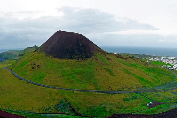
Eldfell, or “Hill of Fire,” is a volcanic cone on Heimaey, the largest of the Westman Islands off Iceland’s south coast. It stands about 200 meters tall and was formed during an eruption on January 23, 1973, which lasted until early July. The eruption added around 2.5 square kilometers of land to the island, making it about 20% bigger. Lava almost blocked Heimaey’s harbor, which was crucial for the island’s fishing industry. To stop it, locals sprayed seawater on the lava, and it worked – the harbor was saved.
You can hike up Eldfell in 20 to 30 minutes and get great views of the island and ocean. The Eldheimar Museum tells the story of the eruption, showing how homes were buried in ash and how the island recovered. While you’re there, you can check out puffins at Stórhöfði or see Elephant Rock by the shore. Eldfell is a reminder of how active Iceland’s volcanoes are and how people here deal with them.
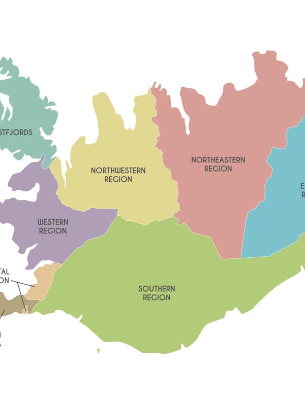
Iceland’s Volcanic Zones
Iceland’s volcanoes aren’t scattered randomly across the island—they're grouped into specific volcanic zones, each shaped by the movement of tectonic plates and hotspots beneath the surface. These zones stretch across different parts of the country, with some areas being more active than others.
Reykjanes Volcanic Zone (RVZ)
The Reykjanes Volcanic Zone runs from the Mid-Atlantic Ridge into southwestern Iceland. It’s home to volcanoes like Fagradalsfjall, Hengill, and Svartsengi. There’s been a lot of action here recently—Fagradalsfjall erupted in 2021 and 2022, and Litli-Hrútur joined in 2023. It’s one of those places where lava flows, and steam vents are just part of the landscape.
West Volcanic Zone (WVZ)
The West Volcanic Zone sits in western Iceland and includes Hengill, Hveravellir, and Skjaldbreiður. This area has plenty of geothermal spots and ongoing rifting. People often visit the hot springs and see the steam rising from the ground, which is a reminder that there’s still plenty going on underground.
East Volcanic Zone (EVZ)
The East Volcanic Zone is home to some of Iceland’s most active volcanoes—Hekla, Katla, Eyjafjallajökull, and Grímsvötn. Eyjafjallajökull’s 2010 eruption made headlines when it shut down air travel across Europe. This part of Iceland is always busy, and eruptions here have shaped much of the landscape.
North Volcanic Zone (NVZ)
Up north, the North Volcanic Zone covers areas like Krafla, Askja, and Theistareykjarbunga. Krafla had a string of eruptions from 1975 to 1984, and the geothermal fields around it are still pretty active. The whole area looks a bit otherworldly, and it’s popular with people who like hiking through volcanic terrain.
Snæfellsnes Volcanic Belt (SVB)
The Snæfellsnes Peninsula is known for Snæfellsjökull, a glacier-covered volcano that’s part of the Snæfellsnes Volcanic Belt. The volcano stands out along the coast, and the surrounding area is full of smaller volcanic formations.
Öræfajökull Volcanic Belt (ÖVB)
Öræfajökull, the highest volcano in Iceland, sits in this belt. It’s had some big eruptions in the past but hasn’t done much lately.
Tjörnes Fracture Zone (TFZ)
The Tjörnes Fracture Zone connects the North Volcanic Zone to the Kolbeinsey Ridge offshore. It’s more about earthquakes than volcanoes, but there are still some smaller systems here. The area shakes now and then, but it’s not something people think about too much unless there’s a bigger quake.
South Iceland Seismic Zone (SISZ)
The South Iceland Seismic Zone links the East and West Volcanic Zones. This area mostly deals with earthquakes from time to time. There aren’t any major volcanoes here, but the faults make sure the ground stays active. People go about their lives, and the occasional quake is just part of living in this part of Iceland.
Best Ways to Experience Iceland's Volcanoes
Offering diverse and captivating volcanic landscapes, Iceland has something for every explorer. For a full immersion in their beauty, consider a variety of exploration experiences:
- Guided tours provide expert knowledge and safety
- Self-driving trips offer flexibility and independence
- Scenic helicopter rides provide a truly breathtaking perspective over Iceland’s volcanic wonders
- Thrilling hiking adventures allow you to explore the country’s unique terrain
Each of these experiences offers a unique perspective and opportunity to witness the incredible geological forces that have shaped Iceland’s landmass. Whether you’re a first-time visitor or a seasoned explorer, there’s always something new and awe-inspiring to discover in Iceland’s volcanic landscapes.
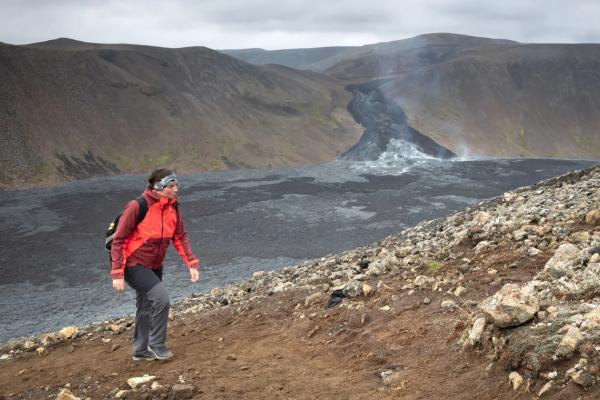
Guided Tours
Guided tours provide a safe, informative exploration of Iceland’s volcanoes. They equip visitors with expert knowledge on the region’s geological history and prepare them to navigate the terrain and potential hazards. From helicopter tours to guided hikes, there are numerous options to suit any interest and fitness level.
By embarking on a guided tour, you’ll not only gain invaluable insights into the geological forces at play but also enjoy the convenience and safety afforded by professional guides. So, whether you’re descending into a dormant magma chamber or marveling at the aftermath of a recent eruption, a guided tour is the perfect way to experience Iceland’s volcanic wonders.
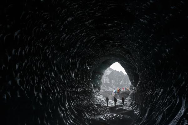
Self-Driving Trips
Renting a car and embarking on a self-driving trip is a popular way to explore Iceland’s volcanic landscapes. This option allows for flexibility and independence, enabling you to tailor your itinerary to your personal preferences and timetable. When choosing a rental car, consider the terrain you’ll encounter and select a vehicle that best meets your needs.
Before setting out on your self-driving adventure, ensure you’re familiar with Iceland’s road safety guidelines and any potential hazards. Always watch weather and volcanic activity updates, and be prepared to adjust your plans if necessary.
With a little preparation and a spirit of adventure, a self-driving trip is an excellent way to discover the incredible beauty of Iceland’s volcanoes.
Helicopter Rides
For a truly unforgettable experience, consider a helicopter ride over Iceland’s volcanic landscapes. Witness the breathtaking beauty of the country’s geological wonders from above, marveling at the vast expanses of lava fields, glacial ice, and rugged terrain that make Iceland so unique.
Helicopter tours offer a bird’s-eye view of the forces that have shaped Iceland’s landmass, providing an unparalleled perspective on the country’s incredible volcanic activity. Whether you’re soaring above the famous Eyjafjallajökull volcano or marveling at the vibrant colors of the Askja caldera, a helicopter ride is an unforgettable experience that you’ll cherish for years to come.
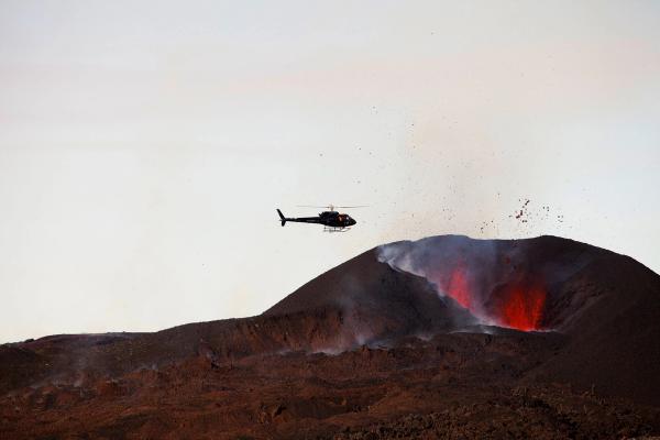
Hiking Adventures
For those who prefer to explore on foot, hiking adventures through Iceland’s volcanic landscapes offer an immersive and exhilarating experience. With a variety of trails and difficulty levels available, there’s a hike suited to every type of adventurer.
Whether you’re trekking through the rugged terrain of the Fagradalsfjall eruption site or scaling the heights of Öræfajökull, a hiking adventure through Iceland’s north volcanic zone promises an unforgettable journey. As you traverse the diverse and ever-changing terrain, take a moment to appreciate:
- the incredible geological forces that have shaped this unique land
- the stunning views of lava fields, craters, and volcanic peaks
- the opportunity to witness active volcanic activity up close
- the chance to explore hidden caves and lava tubes
- the rich biodiversity that thrives in these volcanic environments
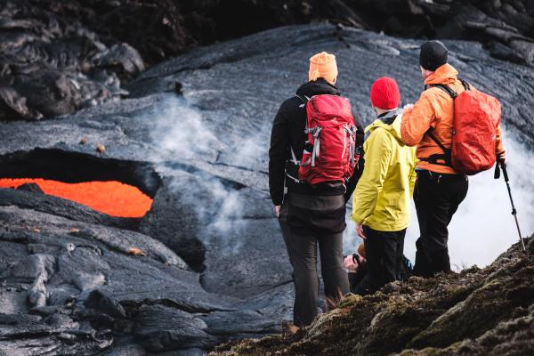
Summary
Iceland’s volcanic landscapes are full of exciting experiences, whether you’re joining a guided tour, driving yourself, hopping on a helicopter, or heading out for a hike. Each option lets you see the powerful geological forces that shaped the country in a different way.
As you plan your Icelandic volcano adventure, remember to prioritize safety, stay informed, and respect the natural environment. With proper preparation and a spirit of adventure, you’ll undoubtedly create memories that will last a lifetime as you explore the awe-inspiring beauty of Iceland’s volcanoes.

